A crawler-mounted drill rig working the South Thompson river flats encounters something we know well in Kamloops: a sudden lens of soft, grey clay beneath a stiff crust. The operator adjusts the auger speed, and the sample coming up the hollow stem confirms what the landscape suggests. That sequence of advance, refusal, and retrieval drives the logic behind a raft foundation design here. We run SPT and Shelby tube samples on the same borehole because the city’s post-glacial stratigraphy — from the lacustrine silts of Aberdeen to the coarser fans near Batchelor Heights — demands a continuous strength profile. Data from CPT testing lets us map the depth to the competent till, which is rarely uniform across a single lot. In our experience, the decision to float a structure on a rigid mat rather than isolate footings comes down to that vertical variability, combined with the seismic hazard level defined by NBCC 2020 for the interior plateau.
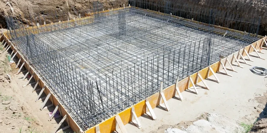
In Kamloops, a mat foundation isn’t just a slab — it’s a settlement-compensating element that bridges the stiff crust and the soft clay beneath in one rigid plane.